Les pays de la Corne de l’Afrique et le Yémen réitèrent leur engagement à éradiquer les variants du poliovirus
STRENGTHENING THE USE OF GEOGRAPHIC INFORMATION SYSTEMS & MHEALTH SOLUTIONS TO REACH ALL POPULATIONS
Geospatial technology enables spatial representation of data to support better public health planning and decision-making. The AFRO Geographic Information Systems (GIS) Center leverages, therefore, GIS and mHealth tools to ensure timely data collection, analysis and reporting and may contribute to improved quality of surveillance and outbreak response in the African Region. By connecting maps, apps, data and people, the AFRO GIS Centre is dedicated to support countries and partners to make informed public health decisions faster.
120 GIS focal points established across 45 African countries

12 trainings conducted since 2017 for improved data analysis & information visualization capacity

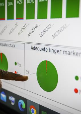
47 Countries equipped with Smart TVs to visualize ISS / eSURV / AVADAR for informed decisions

Over 100 teams equipped with laptops and cellphones to support country operations for polio and other health programs
The 67th World Health Assembly (WHA) urged Member States to prioritize the development and greater use of digital technologies in health to promote Universal Health Coverage and advance the Sustainable Development Goals. In line with this call by the WHA, the Polio Eradication Programme (PEP) at the World Health Organization Regional Office for Africa, has over the years, put in place several innovative solutions to support regional and national interventions in surveillance, routine immunization, monitoring and evaluation, to attain the eradication of polio in the African region. To ensure the sustainable use of these innovative solutions and to support all member states of the WHO African Region, PEP, with support from the Bill & Melinda Gates Foundation (BMGF), established a regional AFRO GIS Center which was inaugurated by the by the World Health Organization Regional Director for Africa, Dr Matshidiso Moeti in February 2017.
Since its establishment, several digital health solutions were put in place at regional and country levels to support implementing both the Polio end-game strategy.
To improve the health and wellbeing of people through the collective investment and effective application of Geographic Information Systems (GIS) and mobile technological solutions to provide timely and reliable geospatial information to support polio eradication efforts, health emergencies and other public health initiatives.
The AFRO GIS Center leverages GIS tools to ensure equitable access to essential health services for everyone. Geographic Information System (GIS) technologies create new opportunities for growth, especially in critical fields such as health and telemedicine, land management, agriculture, and mobility. GIS's powerful mapping and data analytics form a foundation for some of the most successful public health and economic strategies countries pursue today.
The AFRO GIS Center’s role is mainly to ensure proper national adoption of GIS and build the required capacity in relevant knowledge areas at all levels. Furthermore, the GIS centre specifically supports regional and national interventions in surveillance, routine immunization, supportive immunization activities, information management, monitoring and evaluation, as well as accountability of teams and individuals at all levels.
The AFRO GIS Center combats public health disasters using digital maps to plan outbreak interventions. Geospatial tools enable AFRO to account for every person in health system planning, ensuring that even the hardest-to-reach populations have equitable access to vaccination and treatment coverage. Some of the major achievements by the AFRO GIS centre using digital health solutions are the following: